

The 3D representations of
buildings in Google Maps have been enhanced, with more than 1,000 landmarks
across the world available to check out in detailed imagery. The new renderings
look more like the real buildings with shadows and smoother curves, but they’re
available just in Google Maps online for now. Some of the notable improved
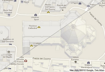
sites include the Piazza del Duomo in Florence, Italy, the Burj Khaifa in Dubai, the Sydney Opera House in Australia, the White House, and the Petronas Towers in Kuala Lumpur, Malaysia.

Google Maps
GL, which is the in-browser hardware-accelerated 3D graphics version of the
service with smoother transitions between imagery, is yet to receive the
updated 3D landmark renderings. Paul Messmer, a Google Maps software engineer, said in a blog post that the feature will be available
soon on Google MapsGL. There was no mention though on when this would be
available on the mobile versions of Google Maps. Messmer believes the improved
3D rendering will be of particular use to tourists: “It's much easier to get a
sense of your location by simply comparing the shapes of buildings on the map
to what you see out your window. By combining 3D buildings with other Google
Maps features like Street View and driving directions, you'll have the most
advanced ‘tourist map’ on the planet.”
Google has been on a roll in recent
months in improving its mapping products. Of note are the 45 degree satellite imagery available in Google Maps, and the
Google Earth 6.2 rendering engine
update from patchy long-range
imagery that smoothes out the quilt of images.
No comments:
Post a Comment